
Quantzig, a leading analytics advisory firm that delivers customized analytics solutions, has announced the completion of its new article on geospatial data analytics. Through this article, Quantzig explains how geospatial data analytics is helping government bodies and healthcare researchers to curb COVID-19 by tracking and analyzing disease progression patterns in real-time.
This press release features multimedia. View the full release here: https://www.businesswire.com/news/home/20200323005392/en/
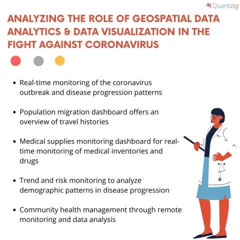
Benefits of Geospatial Data Analytics (Graphic: Business Wire)
Advances in technology and location tracking systems have given rise to staggering volumes of spatial datasets that can offer details on the COVID-19 outbreak if analyzed accurately. With fresh cases of coronavirus being reported across countries, government bodies and research organizations are now investing in Geospatial data analytics. Geospatial data analytics can help capture and analyze the location and spatial data sets on real-time dashboards that offer graphical interpretations with detailed visualizations of disease patterns. At Quantzig, we believe that the use of advanced geospatial data analytics solutions to track and monitor disease progression can help curb the disease significantly. And what better time than now to make the most of spatial data.
As an increasing number of cases begin to emerge from different countries, researchers and other healthcare professionals have started leveraging geospatial data analytics to analyze data and take the right measures to curb the disease.
We’ve got the right solutions that’ll help you analyze disease patterns in real-time. Get in touch with our experts to know more about the role of geospatial data analytics in curbing the pandemic.
Benefits of Geospatial Data Analytics
1: Make analytics insights more engaging through interactive visualizations & data dashboards
It’s crucial to ensure that data-driven insights are accessible and engaging by deploying interactive dashboards. Mapping of trends and real-time events on data dashboards, make it easier to analyze and act upon. Geospatial data mining empowers businesses to do just that by leveraging data and location-based insights to analyze factors leading to disease progression.
Quantzig can help you develop and implement advanced data dashboards. Request a free demo to know more about our advanced analytics solutions.
2: Leverage predictive analytics insights to predict possible events or occurrence of diseases
Geospatial data analytics can help organizations and government officials to anticipate and prepare for possible changes based on spatial conditions and location-based events.
We can help you drive profitable growth by helping you turn spatial data into valuable insights. Request a FREE proof of concept to get started.
3: Develop targeted solutions and drugs based on location-specific insights to control the situation
Location analytics in combination with geospatial big data analytics can help healthcare decision-makers understand why certain formulations that work in one region often fail in another. It can also help government bodies to understand various aspects of an outbreak by monitoring and tracking it in real-time.
Read the complete article for detailed insights.
About Quantzig
Quantzig is a global analytics and advisory firm with offices in the US, UK, Canada, China, and India. For more than 15 years, we have assisted our clients across the globe with end-to-end data modeling capabilities to leverage analytics for prudent decision making. Today, our firm consists of 120+ clients, including 45 Fortune 500 companies. For more information on our engagement policies and pricing plans, visit: https://www.quantzig.com/request-for-proposal

View source version on businesswire.com: https://www.businesswire.com/news/home/20200323005392/en/